Middle Tennessee prepares for remnants of Hurricane Helene
Soaking downpours, gusty wind and flooding are the main threats.
NASHVILLE, Tenn. (WSMV) - After Hurricane Helene makes landfall late Thursday evening in Florida, its path is expected to continue on to Tennessee, bringing heavy tropical downpours, gusty wind and even a flooding threat to the Midstate.
We could experience soaking windswept rain as soon as this evening and lasting through the day Friday, even into the weekend. Currently, Middle Tennessee is under a Flood Watch and a Wind Advisory until Saturday morning.
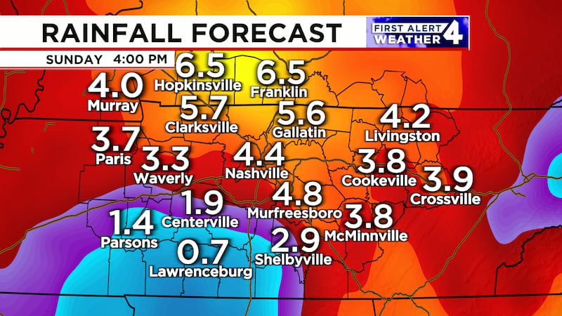
Latest model estimates show that Middle Tennessee and Southern Kentucky could get as much as 6 inches of rain in some spots. The areas that will see the highest rainfall totals will be east of I-24. That’s where we could see 4-6 inches of rain through the weekend. Spots west of I-24 will see about an inch up to 3 inches of rainfall.
During this time, make sure to secure any outdoor objects, including patio furniture and umbrellas. Also, watch out for heavy ponding on roadways and in poor drainage or flood-prone areas.
Helene is expected to make landfall Thursday night as a Category 3 Hurricane. Some models even suggest a Category 4. Helene will continue to push inland as it weakens to a tropical storm, then eventually a tropical depression through the weekend.
Copyright 2024 WSMV. All rights reserved.