First Alert Weather: Frigid cold, late week Winter Storm
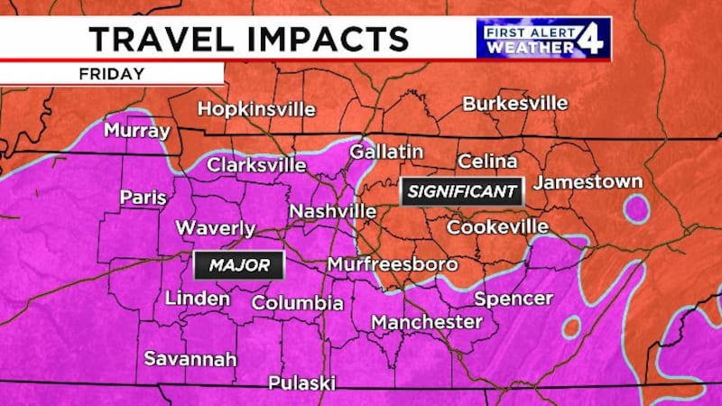
Significant travel impacts expected
NASHVILLE, Tenn. (WSMV) - Preparations should begin now for a major winter storm later this week.
TODAY THROUGH THURSDAY
Arctic air remains in place this week with temperatures struggling to get past that freezing mark today. Many of us are going to end up in the mid 30s this afternoon under a mix of sun and clouds. Flurries at times through this afternoon.
Tonight, will be cold with temperatures in the low 20s by tomorrow morning.
Highs on Wednesday will once again have a tough time getting back to that freezing mark with a mix of clouds and sunshine through the afternoon.
Wednesday night will be the coldest night of the week with overnight lows dropping into the teens by Thursday morning.
Clouds will increase Thursday afternoon as temperatures barley get past that freezing mark in the afternoon.
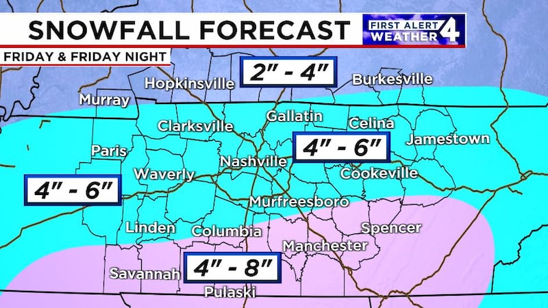
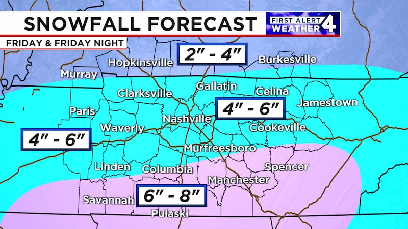
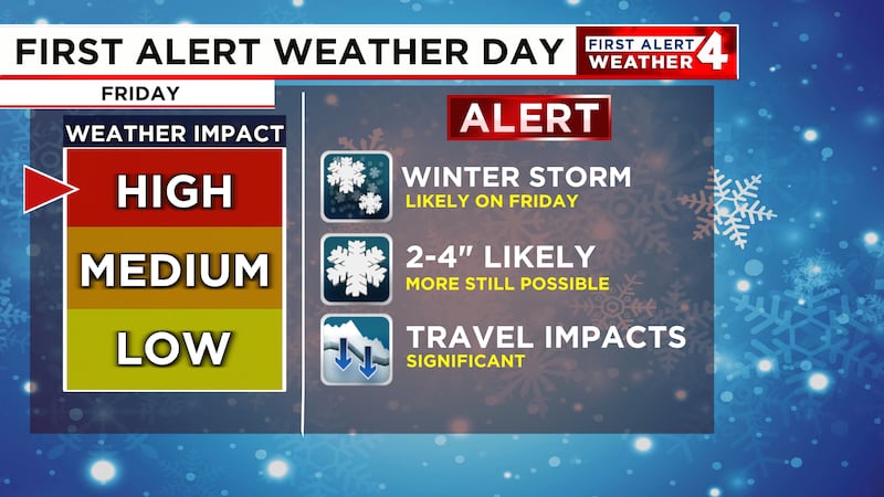
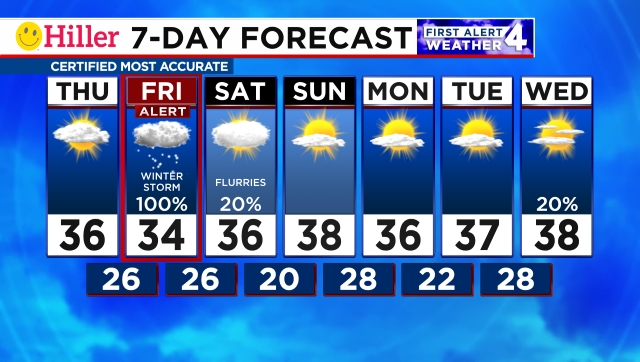
FIRST ALERT WEATHER DAY - FRIDAY
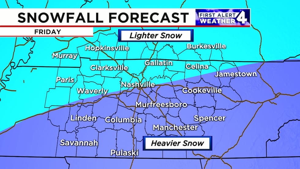
A major winter storm is set to arrive in the Midstate on Friday, and this time it’s looking like an all-snow event for the Midstate.
Snow will develop in Middle Tennessee and Southern Kentucky throughout the morning on Friday, where it will continue for much of the day. We are looking at a healthy amount of snowfall across most of the Midstate with at least a good 2-4″ across most of the area, but there could be more in some isolated spots in southern Middle Tennessee. Of course, there is still time to see some changes to the forecast so stick with us here on WSMV 4 for the latest updates.
Either way, travel will likely become extremely difficult throughout the day on Friday and impacts will linger into early Saturday as well.
Download the WSMV 4 First Alert Weather app for iPhone or Android, so you can stay informed on the go and in between newscasts. We share custom videos, plus you can choose to get messages from us on the latest conditions and forecasts.
THIS WEEKEND
Slightly milder weather will continue Saturday and Sunday with highs in the upper 30s to near 40. Overnight lows however will still drop in the 20s this weekend.
There may be a lingering flurry on Saturday, but Sunday looks dry with a mix of clouds and sunshine.
Have weather pictures or videos? Share them here.
Copyright 2025 WSMV. All rights reserved.