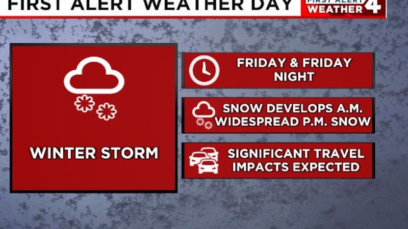
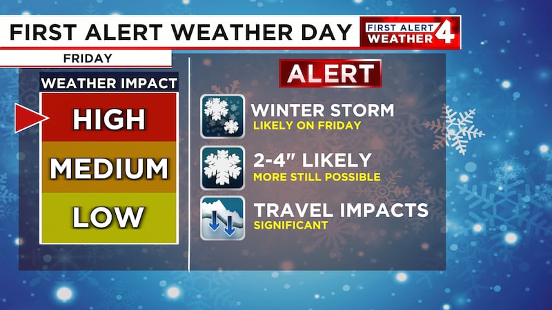
Winter Storm to impact travel on Friday
A First Alert Weather Day continues for Friday as significant travel impacts are expected with an incoming winter storm
NASHVILLE, Tenn. (WSMV) - We continue to track a winter storm that has its sights on the Midstate for Friday and Friday evening.
FIRST ALERT WEATHER DAY - FRIDAY
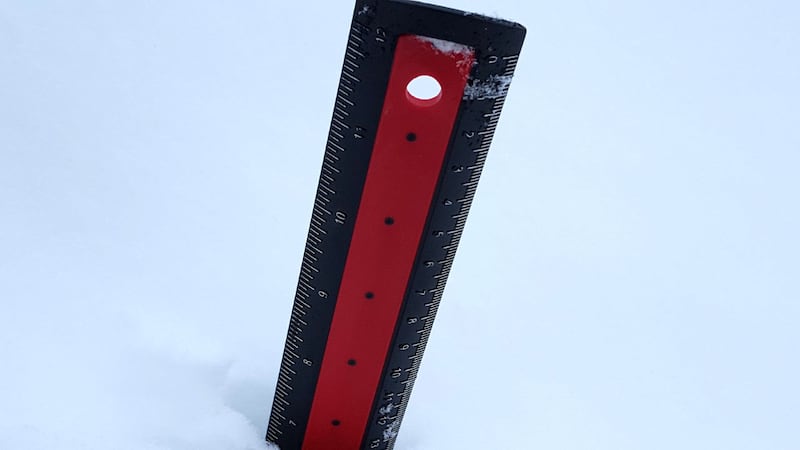
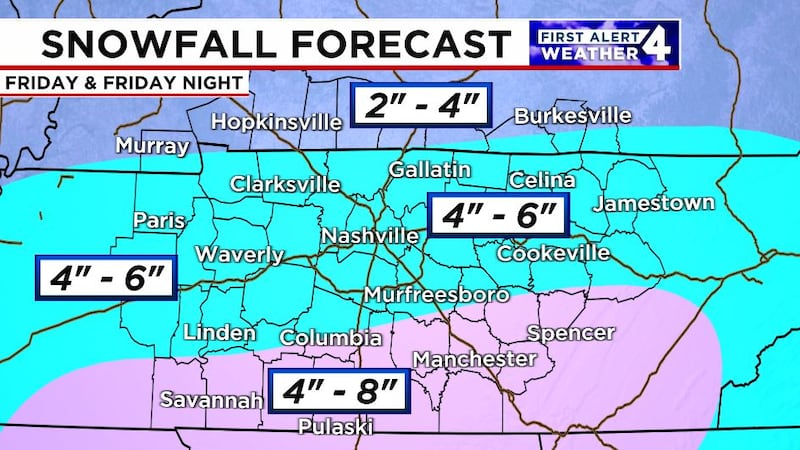
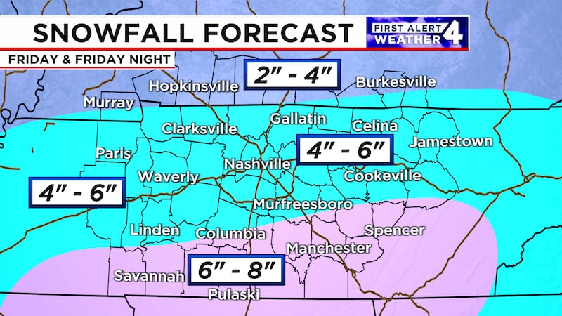
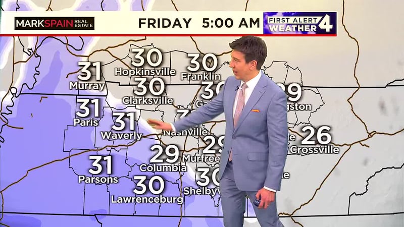
Snow is expected to develop before sunrise along the Tennessee River and spread eastward across the Midstate through our morning commute. Snow will continue across the area for much of the day with most of the Midstate receiving at least 3″ of snowfall with some areas expected to get even more the farther south we go. Some areas in southern Middle Tennessee could push to the 5-7″ mark before all the snow wraps up overnight on Friday.
Travel is likely to be significantly impacted throughout the day on Friday and into at least early Saturday. If you must travel be sure to allow yourself plenty of extra time and take it slow on those snow-covered roadways. Flights in and out of the Nashville International Airport will likely be impacted as well throughout the day.
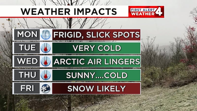
TODAY AND THURSDAY
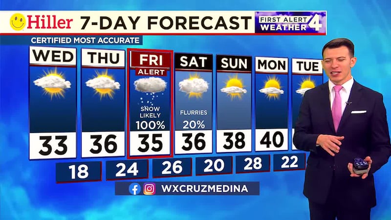
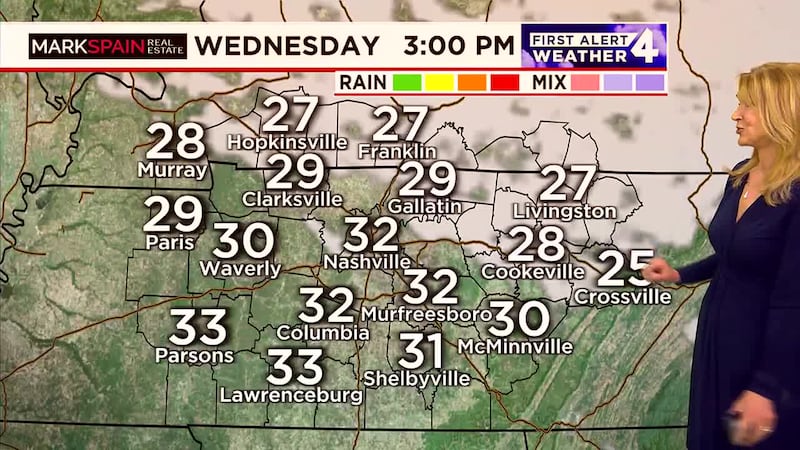
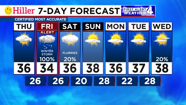
Arctic air will stick with the Midstate Wednesday and Thursday with temperatures in the lower to mid-30s and overnight lows in the 20s and teens. Make sure that you stay bundled up but at least the weather will remain calm so we can prepare for our winter storm on Friday.
THIS WEEKEND
Travel impact from our winter storm will linger into Saturday morning so if you have travel plans just be ready to allow for some extra time early in the day. Saturday afternoon will be mostly cloudy with some leftover flurries and temperatures in the mid-30s.
Sunday will be slightly warmer with temperatures in the upper 30s and a little afternoon sunshine. As snow melts during the day we could see refreezing overnight with lows in the 20s and teens once again.
NEXT WEEK
Temperatures Monday and Tuesday will range from the mid-30s to near 40 in the afternoon with a mix of clouds and sunshine both days.
Have weather pictures or videos? Share them here.
Download the WSMV 4 First Alert Weather app for iPhone or Android, so you can stay informed on the go and in between newscasts. We share custom videos, plus you can choose to get messages from us on the latest conditions and forecasts.
Copyright 2025 WSMV. All rights reserved.