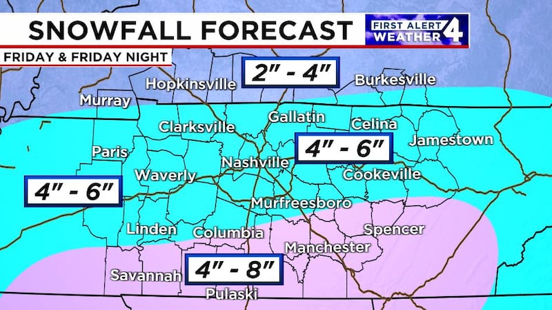
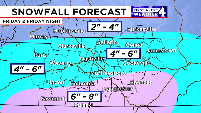
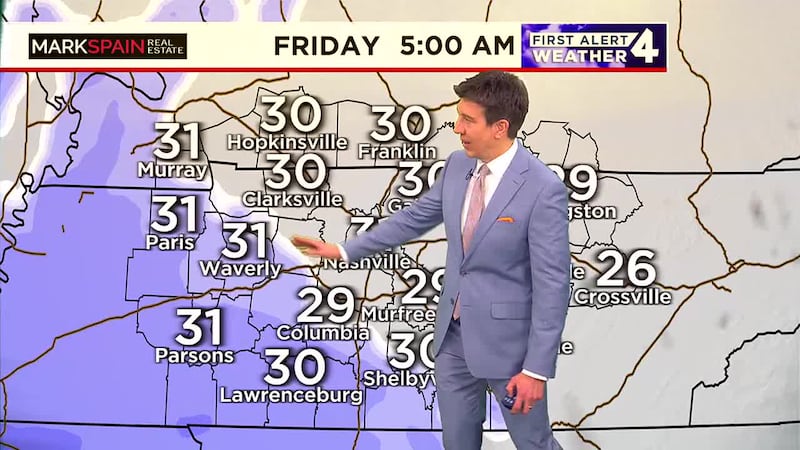
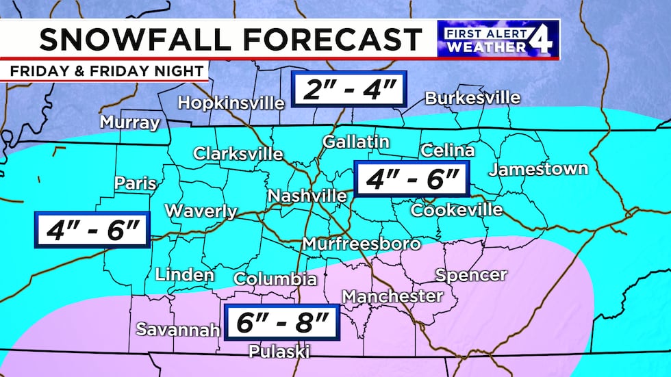
Expected snow totals for the Midstate on Friday
Accumulations will vary with the highest amounts in Southern Middle Tennessee.
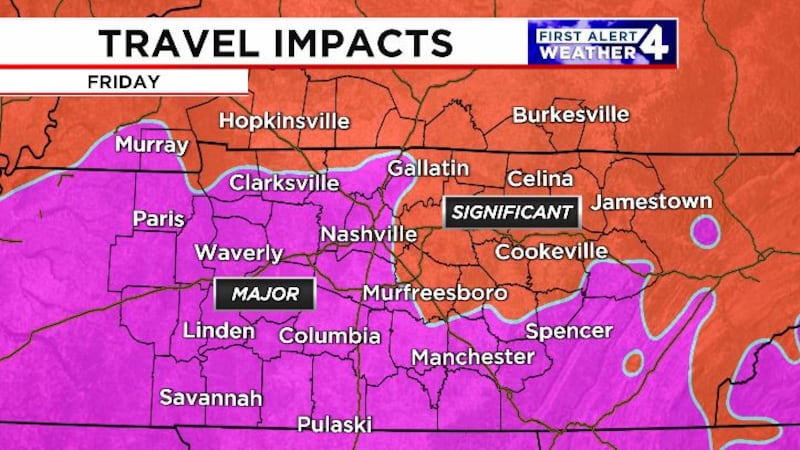
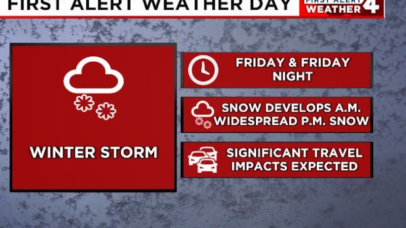
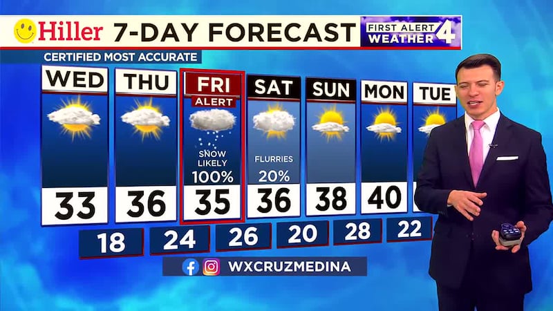
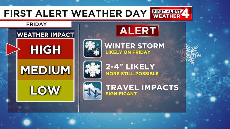
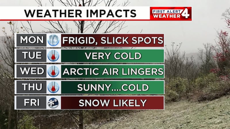
NASHVILLE, Tenn. (WSMV) - A major winter storm takes aim at the Midstate this Friday and will bring multiple inches of accumulating snow.
An area of low pressure will track through the deep south paralleling the Gulf of Mexico. Cold air will be in place for Middle Tennessee which means we’re on the favorable side of the storm system to see all snow.
Snow totals will vary greatly across the Midstate with the highest accumulations expected across southern Middle Tennessee. Where those heavier bands set up, pockets of 6-8″ of snow are expected across the southern tier.
Elsewhere, moderate to heavy snow is expected at times throughout Friday afternoon and evening. Most areas will see between 4-6″ of snow when all is said and done. Slightly lesser amounts are anticipated for Southern Kentucky.
Mixed precipitation is not expected at this time. This will likely be an all-snow event. The snow will start wet and heavy but could end as powdery snow as temperatures drop into the 20s by Friday evening.
Copyright 2025 WSMV. All rights reserved.