Winter storm will bring several inches of snow on Friday
Cold air is expected to hang around through next Wednesday.
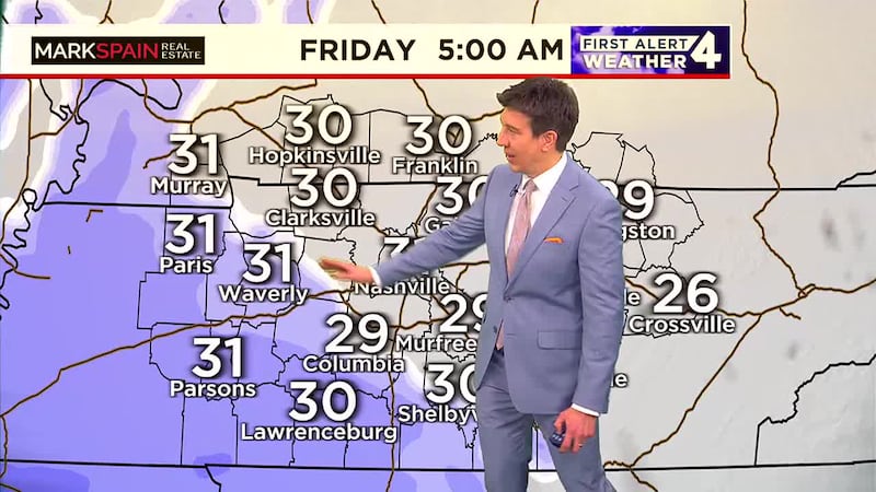
NASHVILLE, Tenn. (WSMV) - Snow will move in from the west early Friday and linger into the evening.
Have weather pictures or videos? Share them here.
Download the WSMV 4 First Alert Weather app for iPhone or Android, so you can stay informed on the go and in between newscasts. We share custom videos, plus you can choose to get messages from us on the latest conditions and forecasts.
TONIGHT & TOMORROW:
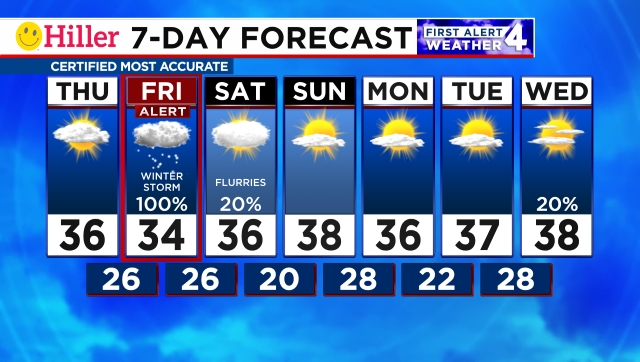
A mainly clear sky is likely overnight allowing temperatures to tumble to their lowest levels in a month. Lows will be in the teens. Nashville should bottom out at 18°.
Tomorrow will begin bitterly cold, but sunny. During the afternoon, clouds will move in from the west and thicken during the evening. Toward sunrise Friday, snow will begin developing from west to east.
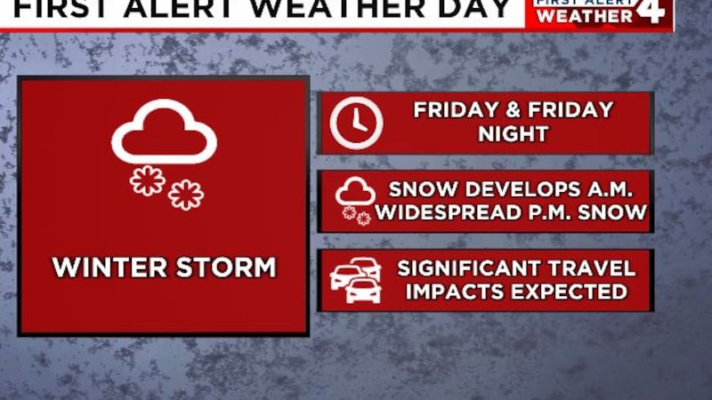
FIRST ALERT WEATHER DAY -- FRIDAY & FRIDAY NIGHT:
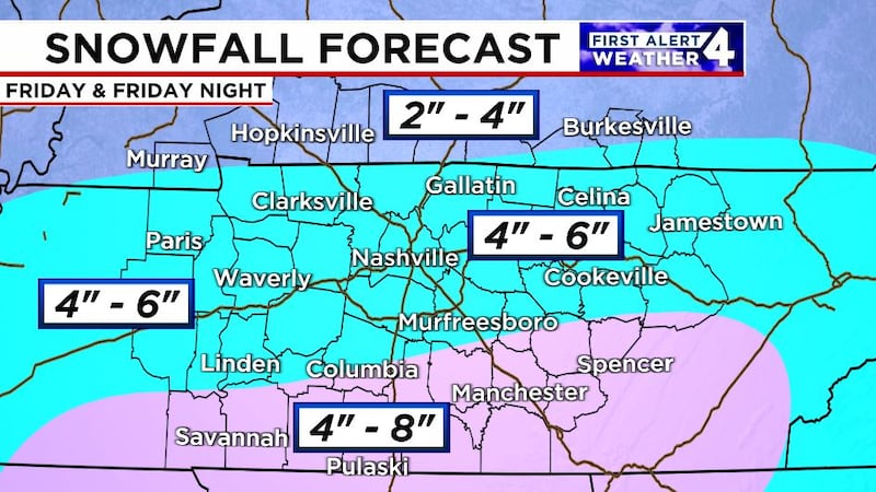
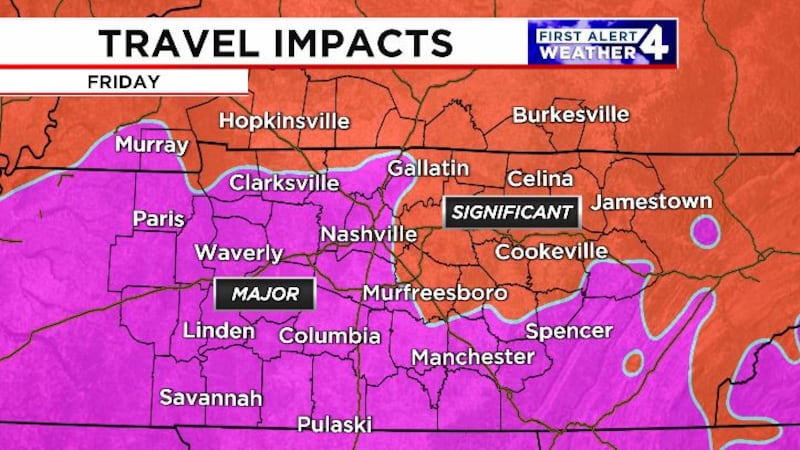
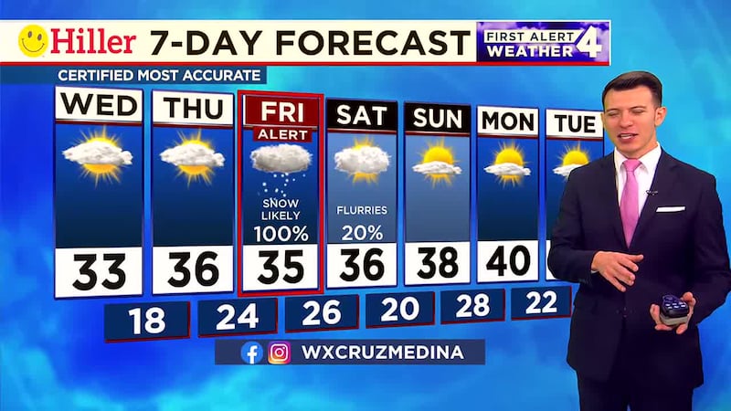
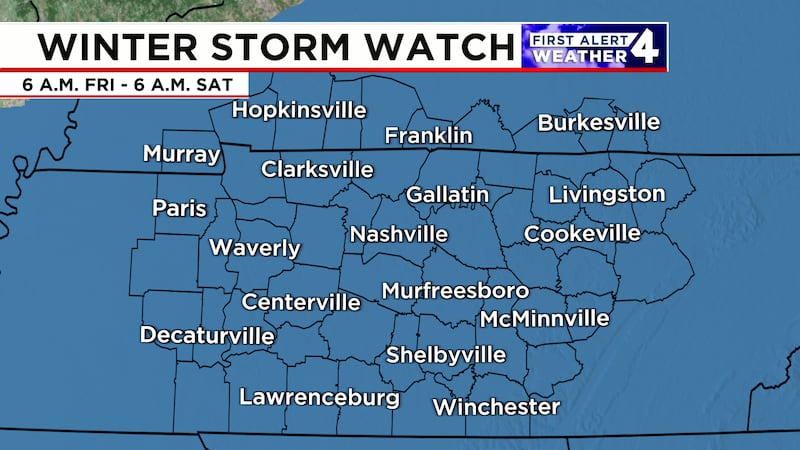
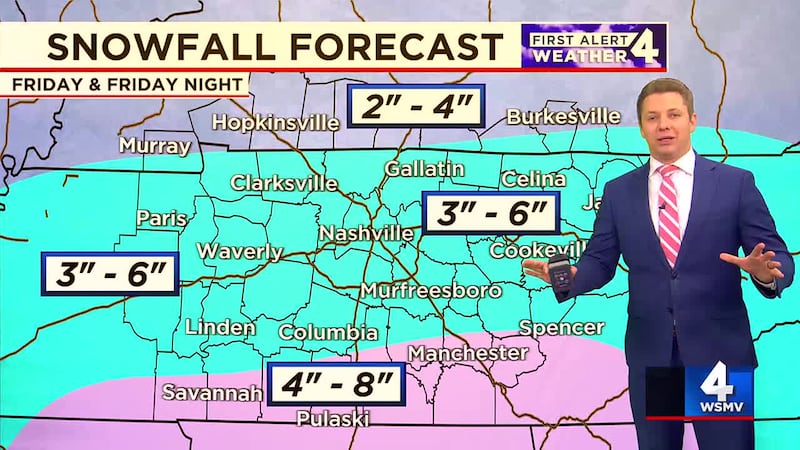
Friday is a First Alert Weather Day. Snow will break out early in the day on Friday, arriving from the southwest. Because of the recent cold, snow will stick as soon as it begins to fall. Snow will expand eastward and intensify through the late morning and afternoon. Roads will quickly become treacherous on Friday. Flights into and out of Nashville International Airport will be affected. Once the snow begins, travel will not be recommended.
Snow will gradually taper off from west to east during the evening on Friday.
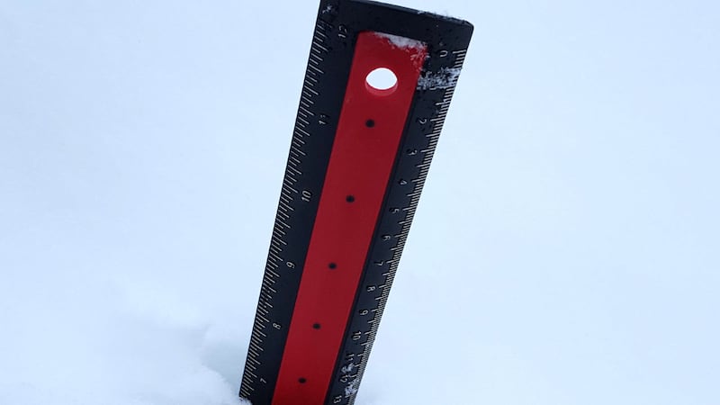
Total snowfall accumulations will be in the 4″ to 6″ range for most of Middle Tennessee. Southern Middle Tennessee could receive slightly more. Northernmost Middle Tennessee and southern Kentucky will likely receive slightly less.
THIS WEEKEND:
Treacherous roads will continue on Saturday. Temperatures will barely make it above freezing. Some improvement is likely on roads Saturday afternoon, mainly where they were pretreated and then shoveled/plowed.
Sunday will turn brighter and slightly warmer during the afternoon. Low, 20. High, 38.
NEXT WEEK:
Monday through Wednesday of next week will all remain abnormally chilly. Count on lows in the 20s and highs in the 30s.
A few flurries will be possible Wednesday.
Much milder weather is likely for Thursday and Friday of next week.
Copyright 2025 WSMV. All rights reserved.