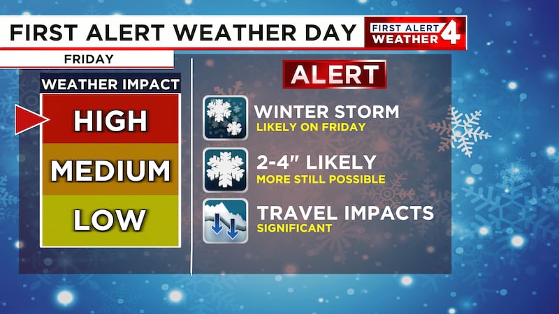
Major winter storm expected Friday
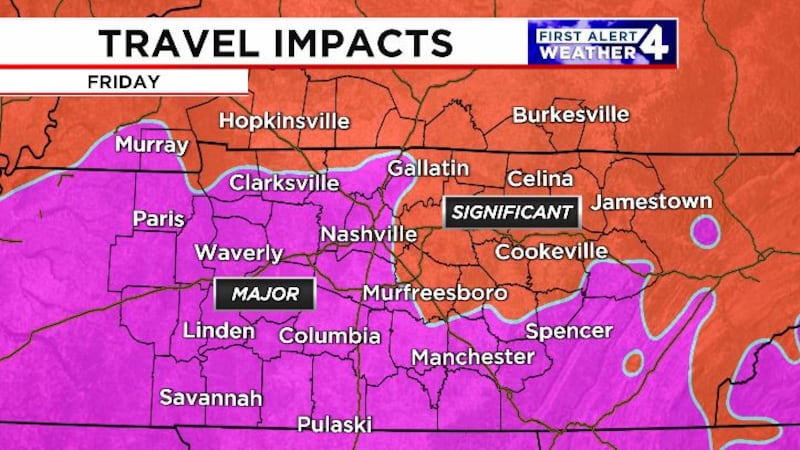
Major travel disruptions expected
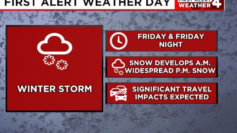
NASHVILLE, Tenn. (WSMV) - FIRST ALERT WEATHER DAY - FRIDAY AND FRIDAY NIGHT
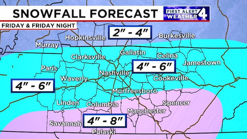
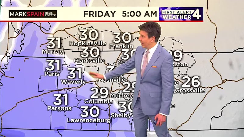
A highly impactful winter storm will impact Middle Tennessee and Southern Kentucky on Friday. Snow will likely start in west Middle Tennessee before sunrise on Friday, between 2am and 5am and then spread eastward across the rest of the Midstate through the morning. Snow will start in Nashville and along I-65 between 4am and 6am and east of I-65 in the Cumberland Plateau between 6am and 8am.
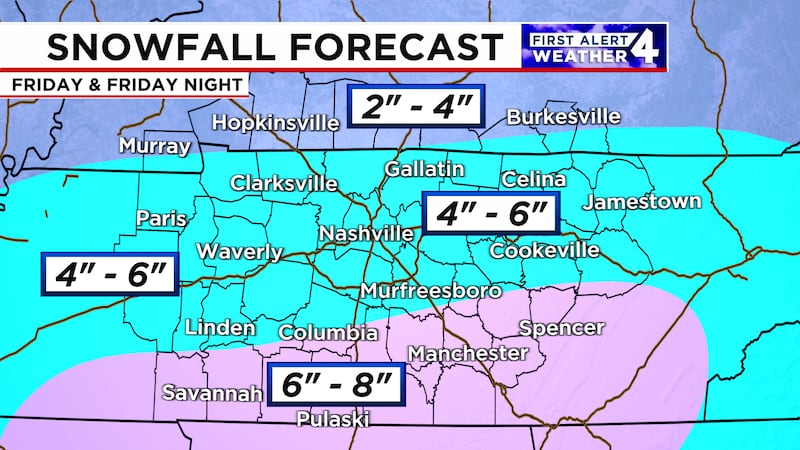
Steady snow will continue through the afternoon, with heavy bands of snow possible in parts of the Midstate. One thing we are watching is the chance for a little mixing in far southern Middle Tennessee that could impact snowfall amounts in those areas.
Expect road conditions to quickly deteriorate and flights into and out of Nashville International Airport will also be affected.
Snow will gradually taper off from west to east during the evening on Friday.
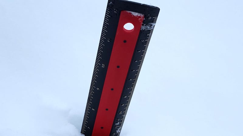
Total snowfall accumulations will be in the 4″ to 6″ range for most of Middle Tennessee. There could be a little more snow accumulation in Southern Middle Tennessee but remember we’re watching for the chance of some mixing in those areas so that could also impact snow totals.
TODAY
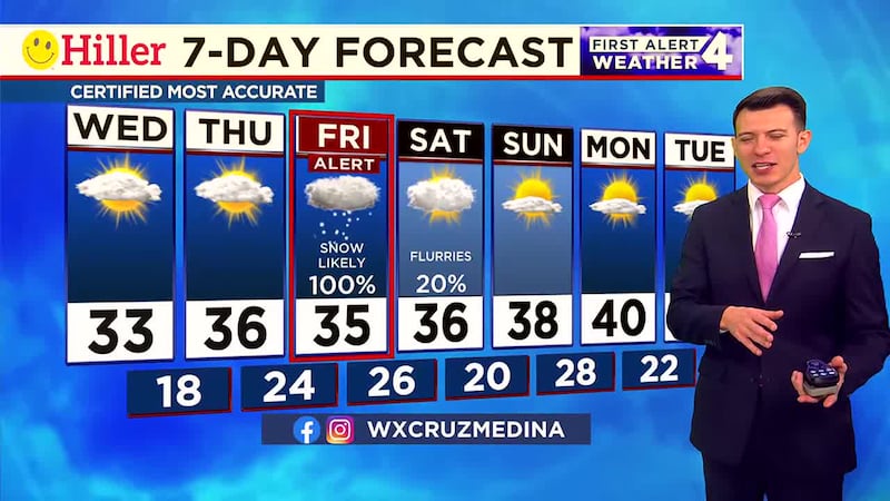
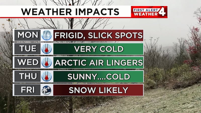
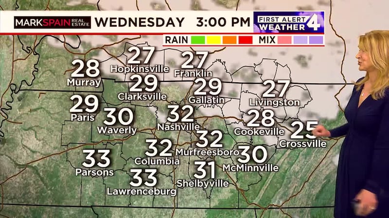
It’s a frigid start to our day and it will stay cold this afternoon with temperatures in the lower to mid 30s. The important thing is that the weather will stay calm today with just a mix of clouds and sunshine as we prepare for our winter storm tomorrow.
THIS WEEKEND:
Treacherous roads will continue on Saturday. Temperatures will barely make it above freezing. Some improvement is likely on roads Saturday afternoon, mainly where they were pretreated and then shoveled/plowed.
Sunday will turn brighter and slightly warmer during the afternoon. Low, 20. High, 38.
NEXT WEEK:
Monday through Wednesday of next week will all remain abnormally chilly. Count on lows in the 20s and highs in the 30s.
A few flurries will be possible Wednesday.
Much milder weather is likely for Thursday and Friday of next week.
Have weather pictures or videos? Share them here.
Download the WSMV 4 First Alert Weather app for iPhone or Android, so you can stay informed on the go and in between newscasts. We share custom videos, plus you can choose to get messages from us on the latest conditions and forecasts.
Copyright 2025 WSMV. All rights reserved.