What does a La Niña winter mean for Middle Tennessee snow chances?
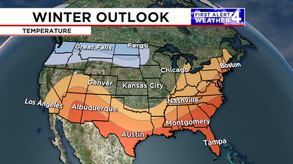
The southern U.S. tends to be warmer and drier during a La Niña winter.
NASHVILLE, Tenn. (WSMV) - The Climate Prediction Center is still predicting a La Niña winter. Do we see snow in the Midstate during La Niña years?
Each winter, many residents of the Midstate are looking forward to a big snowstorm, like the one we had in January of this year. Will that be the case this winter? The answer to that question isn’t as straightforward as one would hope.
The El Niño-Southern Oscillation (ENSO) is characterized by warming or cooling of the sea surface temperatures in the Equatorial Pacific Region. This will be a La Niña winter, characterized by the cooling of sea surface temperatures in the Equatorial Pacific Region.
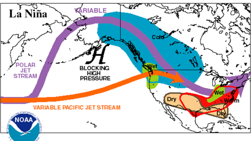
During La Niña winters, the jet stream and overall storm track tend to stay north. This allows warm air to dominate the southern U.S. Since this is a weak La Niña, the local effects could vary a bit from the rest of the country.
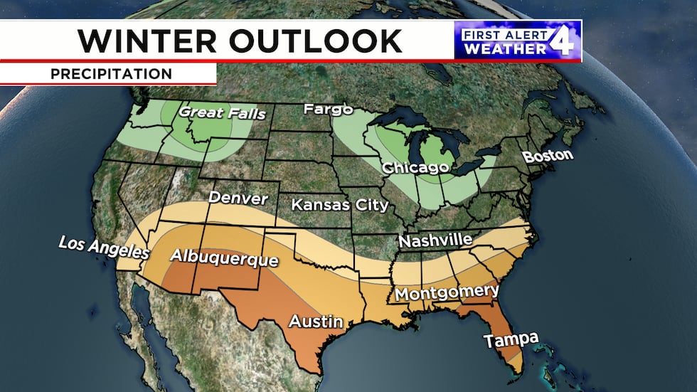
With a more northerly storm track, any above-average precipitation predictions are across the Pacific Northwest and in the Midwest. In the south, because storm systems will stay mainly north, below-average precipitation is expected.
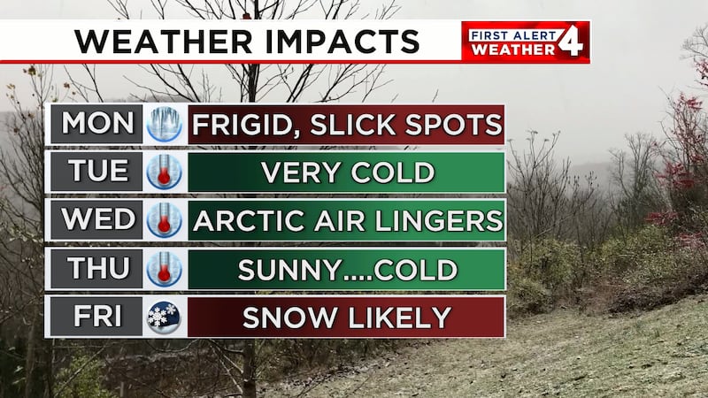
We had La Niña winters recently during the winter 2022-2023 and 2023-2024 seasons. Both seasons ended up with above-average temperatures, but each of those winter seasons also featured a substantial cold snap.
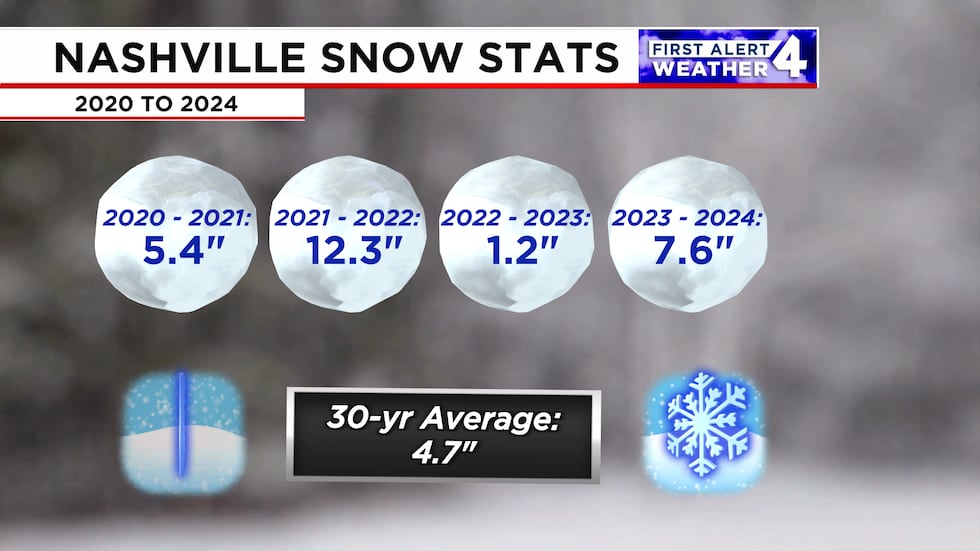
We average 4.7″ of snow in Nashville each winter. All it takes is one substantial snow to end up above average. We saw that back in January with the storm that dumped more than 7″ of snow on the city.
During a La Niña winter, the hardest part will be getting the cold air in place. Even though above-average temperatures are predicted, that does not mean we won’t have snow this winter.
Copyright 2024 WSMV. All rights reserved.