First Alert Weather Day: Rain, ice and snow through Monday
Temperatures fall overnight
NASHVILLE, Tenn. (WSMV) - First Alert Weather Day in effect through tomorrow as rain moves through the mid-state. Temperatures fall over night and changing rain to winter weather.
Rain is moving across Middle Tennessee. Most of the Midstate will see 1-2″ of rain, but no widespread flooding is expected.
As the rain exits overnight into Monday morning, temperatures will drop to below freezing again, changing over the rain to snow. Only a dusting of snow is expected, with a possible 1/2″ for the plateau. The Monday morning commute could be tricky for areas north of I-40 and into the Plateau. Snow exits out of the Plateau by mid-afternoon Monday after a few off and on snow showers. Other areas of Middle Tennessee could see a few flurries.
A Winter Storm Warning is in effect until 6PM Monday for Warren, Monroe, Cumberland and Clinton Counties for 1/2″ of ice and 1-2″ of snow.
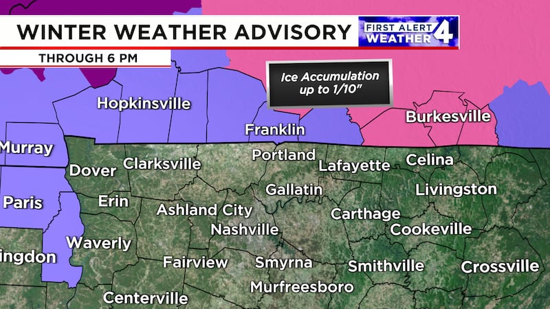
A Winter Weather Advisory is in effect until 6PM Monday for Henry, and Benton Counties in TN and Allen, Christian, Logan, Simpson, Todd and Trigg Counties in KY. A light glaze of ice is possible. Beware of slippery roads.
Copyright 2024 WSMV. All rights reserved.